Geolocate

Posof topographic map

Click on the map to display elevation.

About this map

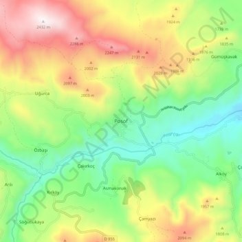
Name: Posof topographic map, elevation, terrain.

Location: Posof, Ardahan, Eastern Anatolia Region, 75800, Turkey (41.46838 42.68795 41.54838 42.76795)

Average elevation: 1,741 m

Minimum elevation: 1,266 m

Maximum elevation: 2,437 m

Gear up for your next adventure:

Ultralight Solo Tents - Compact shelters for multi-day topographic surveying expeditions
💧Personal Water Filters - Drink safely from streams and lakes identified on your map
🍶Collapsible Water Bottles - Save space in your pack as you consume your water supply
🛰️Handheld GPS Units - Rugged GPS devices for tracking coordinates and elevation in the Australian bush
🌧️Rain Jackets - Waterproof jackets for hiking

As an Amazon Associate, this site earns from qualifying purchases at no extra cost to you.