
澄江镇 topographic map
Interactive map
Click on the map to display elevation.
About this map
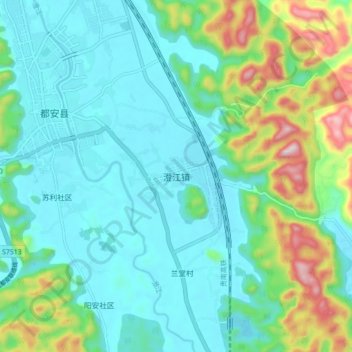
Name: 澄江镇 topographic map, elevation, terrain.
Location: 澄江镇, 都安瑶族自治县, 河池市, 广西壮族自治区, 中国 (23.87952 108.09116 23.95952 108.17116)
Average elevation: 254 m
Minimum elevation: 139 m
Maximum elevation: 638 m
Other topographic maps
Click on a map to view its topography, its elevation and its terrain.