Geolocate

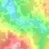
Chartierville topographic map

Click on the map to display elevation.

About this map

Name: Chartierville topographic map, elevation, terrain.

Location: Chartierville, Le Haut-Saint-François, Estrie, Quebec, J0B 1K0, Canada (45.23944 -71.34035 45.35178 -71.13092)

Average elevation: 591 m

Minimum elevation: 385 m

Maximum elevation: 1,018 m

Other topographic maps

Click on a map to view its topography, its elevation and its terrain.

Island Brook

Canada > Quebec > Le Haut-Saint-François > Newport

Average elevation: 340 m

Island Brook

Canada > Quebec > Le Haut-Saint-François > Newport

Average elevation: 340 m

Maple Leaf

Canada > Quebec > Le Haut-Saint-François > Newport

Average elevation: 379 m

Gould

Canada > Quebec > Le Haut-Saint-François > Lingwick

Average elevation: 322 m

Gear up for your next adventure:

🔌Fast Charging Adapters - Quickly top up all your gear before heading back into the field
📦Crushproof Equipment Cases - Safe transport for sensitive surveying and mapping instruments
🧭Global Orienteering Compass - High-precision liquid-filled compasses for accurate map reading and navigation
🥾Heavy Duty Hiking Boots - Ankle-supporting boots for carrying heavy packs on steep contours
🎒40L Day Hiking Backpacks - Comfortable packs with hydration support for long days exploring topographic peaks

As an Amazon Associate, this site earns from qualifying purchases at no extra cost to you.