Geolocate

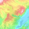
Waitahuna topographic map

Click on the map to display elevation.

About this map

Name: Waitahuna topographic map, elevation, terrain.

Location: Waitahuna, Clutha District, Otago, New Zealand (-46.00900 169.73911 -45.96900 169.77911)

Average elevation: 143 m

Minimum elevation: 92 m

Maximum elevation: 259 m

Other topographic maps

Click on a map to view its topography, its elevation and its terrain.
Waipori River

New Zealand > Otago > Clutha District

Average elevation: 330 m

Ōwaka River

New Zealand > Otago > Clutha District

Average elevation: 179 m

Tahakopa River

New Zealand > Otago > Clutha District

Average elevation: 244 m

Gear up for your next adventure:

🦶Orthotic Hiking Insoles - Extra arch support for long-distance topographic treks
🌧️Rain Jackets - Waterproof jackets for hiking
🥾Hiking Shoes - Lightweight hiking shoes for day hikes
🍴Titanium Spork & Cutlery - Indestructible and feather-light eating utensils
🧤Thermal Hiking Gloves - Keep your hands warm and functional during high-altitude winter treks

As an Amazon Associate, this site earns from qualifying purchases at no extra cost to you.