
Thank you for supporting this site ❤️
Make a donation
Make a donation
Gear up for your next adventure:
As an Amazon Associate, this site earns from qualifying purchases at no extra cost to you.
Tenna topographic map
Click on the map to display elevation.
Thank you for supporting this site ❤️
Make a donation
Make a donation
Gear up for your next adventure:
As an Amazon Associate, this site earns from qualifying purchases at no extra cost to you.
About this map
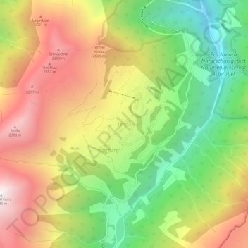
Name: Tenna topographic map, elevation, terrain.
Location: Tenna, Safiental, Surselva, Grisons, 7106, Switzerland (46.72698 9.31903 46.76698 9.35903)
Average elevation: 1,617 m
Minimum elevation: 796 m
Maximum elevation: 2,513 m
Thank you for supporting this site ❤️
Make a donation
Make a donation
Gear up for your next adventure:
As an Amazon Associate, this site earns from qualifying purchases at no extra cost to you.