Geolocate

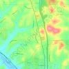
Fernway topographic map

Click on the map to display elevation.

About this map

Name: Fernway topographic map, elevation, terrain.

Location: Fernway, Cranberry Township, Butler County, Pennsylvania, 16066, United States (40.67367 -80.15146 40.72286 -80.10153)

Average elevation: 331 m

Minimum elevation: 296 m

Maximum elevation: 383 m

Other topographic maps

Click on a map to view its topography, its elevation and its terrain.

Gear up for your next adventure:

👖Convertible Hiking Trousers - Zip-off legs to adapt to changing temperatures throughout the day
⛺Lightweight Tents - Compact tents for backpacking
⌚GPS Watches - GPS watches for outdoor sports
👄SPF Lip Balm - Prevent sun and wind-burnt lips on mountain ridges
🔭Compact Hiking Binoculars - Lightweight optics for scouting routes or birdwatching

As an Amazon Associate, this site earns from qualifying purchases at no extra cost to you.