
Make a donation
Gear up for your next adventure:
As an Amazon Associate, this site earns from qualifying purchases at no extra cost to you.
Kharan topographic map
Click on the map to display elevation.
Make a donation
Gear up for your next adventure:
As an Amazon Associate, this site earns from qualifying purchases at no extra cost to you.
About this map
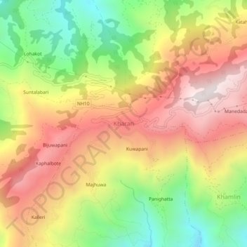
Name: Kharan topographic map, elevation, terrain.
Location: Kharan, Chainpur, Sankhuwasabha, Koshi Province, Nepal (27.25169 87.24490 27.29169 87.28490)
Average elevation: 1,027 m
Minimum elevation: 512 m
Maximum elevation: 1,504 m
Make a donation
Gear up for your next adventure:
As an Amazon Associate, this site earns from qualifying purchases at no extra cost to you.
Other topographic maps
Click on a map to view its topography, its elevation and its terrain.
Arun River
Nepal > Koshi Province > Sankhuwasabha > Num
The Tibetan name Bum-chu may refer to a religious ceremony attempting to divine prospects for the coming year from the level of water in a pot or well, chu is the Tibetan word for water. The river originates near Gutso in Nyalam County of Tibet. Around 17 kilometres (11 mi) downstream, the Men-chu joins it.…
Average elevation: 1,153 m
Make a donation
Gear up for your next adventure:
As an Amazon Associate, this site earns from qualifying purchases at no extra cost to you.