Geolocate

Spring Lake topographic map

Click on the map to display elevation.

About this map

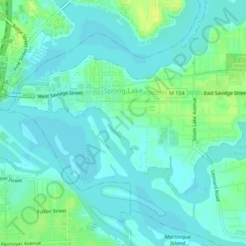
Name: Spring Lake topographic map, elevation, terrain.

Location: Spring Lake, Ottawa County, Michigan, United States (43.06499 -86.21395 43.08128 -86.17491)

Average elevation: 179 m

Minimum elevation: 174 m

Maximum elevation: 190 m

Other topographic maps

Click on a map to view its topography, its elevation and its terrain.

Borculo

United States > Michigan > Ottawa County > Olive Township

Average elevation: 197 m

West Olive

United States > Michigan > Ottawa County

Average elevation: 189 m

Wright

United States > Michigan > Ottawa County > Wright Township

Average elevation: 265 m

Aman Park

United States > Michigan > Ottawa County > Tallmadge

Average elevation: 207 m

Grand Valley

United States > Michigan > Ottawa County

Average elevation: 199 m

Port Sheldon

United States > Michigan > Ottawa County

Average elevation: 185 m

Gear up for your next adventure:

🦟Insect Repellent - Protection against insects
🧥Thermal Emergency Blankets - Compact Mylar blankets to prevent hypothermia if stranded overnight
🎨Portable Watercolor Kits - Paint the landscapes and topographic views you discover
🧥Softshell Jackets - Flexible outdoor jackets
🔪Camping Knives - Multi-purpose outdoor knives

As an Amazon Associate, this site earns from qualifying purchases at no extra cost to you.