
Thank you for supporting this site ❤️
Make a donation
Make a donation
Gear up for your next adventure:
As an Amazon Associate, this site earns from qualifying purchases at no extra cost to you.
Buch topographic map
Click on the map to display elevation.
Thank you for supporting this site ❤️
Make a donation
Make a donation
Gear up for your next adventure:
As an Amazon Associate, this site earns from qualifying purchases at no extra cost to you.
About this map
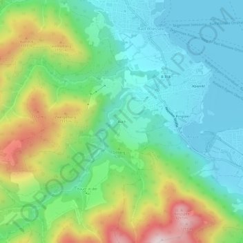
Name: Buch topographic map, elevation, terrain.
Location: Buch, Bad Wiessee, Landkreis Miesbach, Bavaria, 83707, Germany (47.67748 11.69839 47.71748 11.73839)
Average elevation: 904 m
Minimum elevation: 723 m
Maximum elevation: 1,307 m
Thank you for supporting this site ❤️
Make a donation
Make a donation
Gear up for your next adventure:
As an Amazon Associate, this site earns from qualifying purchases at no extra cost to you.