Geolocate

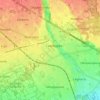
Barza topographic map

Click on the map to display elevation.

About this map

Name: Barza topographic map, elevation, terrain.

Location: Barza, Ispra, Varese, Lombardy, 21027, Italy (45.77852 8.60172 45.81852 8.64172)

Average elevation: 226 m

Minimum elevation: 191 m

Maximum elevation: 301 m

Other topographic maps

Click on a map to view its topography, its elevation and its terrain.

Laveno-Mombello

Italy > Lombardy > Varese

Average elevation: 290 m

Castellanza

Italy > Lombardy > Varese

Average elevation: 221 m

Gear up for your next adventure:

🧯Animal Deterrent Spray - Safety spray for wildlife
🎒Hiking Backpacks - Backpacks designed for hiking and trekking
🍴Titanium Spork & Cutlery - Indestructible and feather-light eating utensils
🧦Merino Wool Hiking Socks - Moisture-wicking socks to prevent blisters during long topographic surveys
🥾Hiking Boots - Durable hiking boots for trails and rough terrain

As an Amazon Associate, this site earns from qualifying purchases at no extra cost to you.