Geolocate

Asenray topographic map

Click on the map to display elevation.

About this map

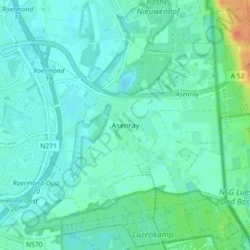
Name: Asenray topographic map, elevation, terrain.

Location: Asenray, Roermond, Limburg, Nederland, 6042 LC, Nederland (51.17459 6.02758 51.21459 6.06758)

Average elevation: 29 m

Minimum elevation: 21 m

Maximum elevation: 60 m

Other topographic maps

Click on a map to view its topography, its elevation and its terrain.

Roermond

Nederland > Limburg > Roermond

Average elevation: 25 m

Hambeek

Nederland > Limburg > Roermond

Average elevation: 24 m

Gear up for your next adventure:

🕯️Emergency Whistles - Safety whistles for hiking
🔦LED Torches - LED torches for outdoor use
👕UPF 50+ Sun Shirts - Essential protection against the harsh Australian sun during field work
🔋Solar Power Banks - Charge your phone and GPS using the sun while deep in the bush
👄SPF Lip Balm - Prevent sun and wind-burnt lips on mountain ridges

As an Amazon Associate, this site earns from qualifying purchases at no extra cost to you.