
Kiyuya topographic map
Interactive map
Click on the map to display elevation.
About this map
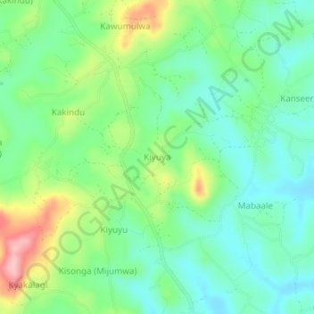
Name: Kiyuya topographic map, elevation, terrain.
Location: Kiyuya, Mubende, Central Region, Uganda (0.60594 31.36887 0.64594 31.40887)
Average elevation: 1,320 m
Minimum elevation: 1,265 m
Maximum elevation: 1,439 m
Other topographic maps
Click on a map to view its topography, its elevation and its terrain.