Geolocate

Gatesgarth topographic map

Click on the map to display elevation.

About this map

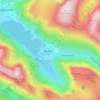
Name: Gatesgarth topographic map, elevation, terrain.

Location: Gatesgarth, Buttermere, Cumberland, England, CA23 3AX, United Kingdom (54.50489 -3.26554 54.54489 -3.22554)

Average elevation: 369 m

Minimum elevation: 99 m

Maximum elevation: 736 m

Gear up for your next adventure:

🔪Multitools - Compact tools for outdoor use
🎽Hiking Clothing - Breathable clothing for hiking
🏃Compression Recovery Socks - Reduce leg fatigue after heavy days of elevation gain
📻Handheld UHF Radios - Critical communication for groups in the Australian outback
🔋Solar Power Banks - Solar chargers for outdoors

As an Amazon Associate, this site earns from qualifying purchases at no extra cost to you.