Geolocate

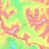
Syari topographic map

Click on the map to display elevation.

About this map

Name: Syari topographic map, elevation, terrain.

Location: Syari, Bhatwari, Uttarkashi, Uttarakhand, India (30.88282 78.56662 30.88292 78.56672)

Average elevation: 3,538 m

Minimum elevation: 2,993 m

Maximum elevation: 3,978 m

Other topographic maps

Click on a map to view its topography, its elevation and its terrain.
Harsil

India > Uttarakhand > Bhatwari

Average elevation: 2,761 m

Kyarkoti Lake

India > Uttarakhand > Bhatwari

Average elevation: 4,043 m

Pari Maatri Taal

India > Uttarakhand > Bhatwari

Average elevation: 4,443 m

Kedar Tal

India > Uttarakhand > Bhatwari

Average elevation: 4,814 m

Pulam Sumda

India > Uttarakhand > Bhatwari

Average elevation: 4,571 m

Gangotri Glacier

India > Uttarakhand > Bhatwari

Average elevation: 5,259 m

Dayara Bugyal

India > Uttarakhand > Bhatwari

Average elevation: 3,451 m

Gangotri Glacier

India > Uttarakhand > Bhatwari

Average elevation: 5,259 m

Kedar Tal

India > Uttarakhand > Bhatwari

Average elevation: 4,814 m

Kalindi Khal Area

India > Uttarakhand > Bhatwari

Average elevation: 5,857 m

Harsil

India > Uttarakhand > Bhatwari

Average elevation: 2,761 m

Gear up for your next adventure:

🧦Hiking Socks - Comfortable socks for long hikes
🧴SPF 50+ Bulk Sunscreen - Maximum protection for long-term outdoor exposure
🥤Hydration Packs - Hydration systems for hiking
🔭Compact Hiking Binoculars - Lightweight optics for scouting routes or birdwatching
🥾Heavy Duty Hiking Boots - Ankle-supporting boots for carrying heavy packs on steep contours

As an Amazon Associate, this site earns from qualifying purchases at no extra cost to you.