
扎玉镇 topographic map
Interactive map
Click on the map to display elevation.
About this map
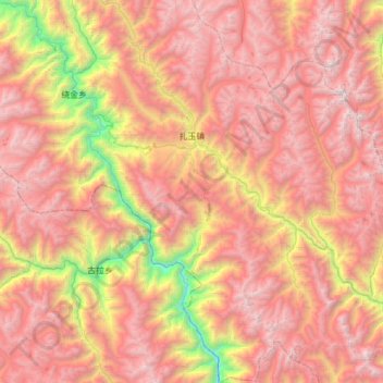
Name: 扎玉镇 topographic map, elevation, terrain.
Location: 扎玉镇, 左贡县, 昌都市, 西藏自治区, 中国 (28.86458 97.86842 29.40595 98.41644)
Average elevation: 4,230 m
Minimum elevation: 2,069 m
Maximum elevation: 5,907 m
Other topographic maps
Click on a map to view its topography, its elevation and its terrain.