Geolocate

Aprilia topographic map

Click on the map to display elevation.

About this map
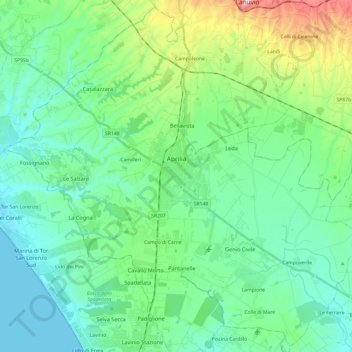
Name: Aprilia topographic map, elevation, terrain.

Location: Aprilia, Latina, Lazio, 04011, Italy (41.49783 12.53016 41.67193 12.77175)

Average elevation: 73 m

Minimum elevation: 0 m

Maximum elevation: 328 m

Gear up for your next adventure:

📷Backpack Camera Clips - Quick access to your camera while keeping your hands free for climbing
📕Hiking Guide Books - Guides for hiking trails
🧥Down Jackets - Insulated jackets for cold weather
🍳Ultralight Camping Stoves - Boil water quickly for meals using minimal fuel
🦯Trekking Poles - Walking poles for hiking stability

As an Amazon Associate, this site earns from qualifying purchases at no extra cost to you.