
Ордабасы topographic map
Interactive map
Click on the map to display elevation.
About this map
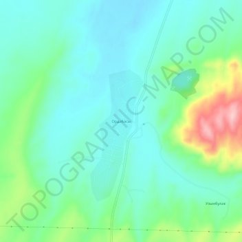
Name: Ордабасы topographic map, elevation, terrain.
Average elevation: 370 m
Minimum elevation: 326 m
Maximum elevation: 503 m
Other topographic maps
Click on a map to view its topography, its elevation and its terrain.
Темирлановка
Казахстан > Туркестанская область > Ордабасынский район
Темирлановка, Ордабасынский район, Туркестанская область, Казахстан
Average elevation: 301 m