
La Rochefoucault topographic map
Interactive map
Click on the map to display elevation.
About this map
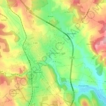
Name: La Rochefoucault topographic map, elevation, terrain.
Average elevation: 1,010 m
Minimum elevation: 932 m
Maximum elevation: 1,092 m
Other topographic maps
Click on a map to view its topography, its elevation and its terrain.
Truc de Bringer
France > Occitanie > Lozère > Saint-Chély-d'Apcher
Truc de Bringer, Saint-Chély-d'Apcher, Mende, Lozère, Occitanie, France métropolitaine, 48200, France
Average elevation: 1,013 m