
Léré topographic map
Interactive map
Click on the map to display elevation.
About this map
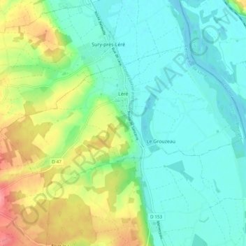
Name: Léré topographic map, elevation, terrain.
Location: Léré, Bourges, Cher, Centro, França metropolitana, 18240, França (47.44409 2.82433 47.48530 2.91918)
Average elevation: 159 m
Minimum elevation: 133 m
Maximum elevation: 219 m
Other topographic maps
Click on a map to view its topography, its elevation and its terrain.