
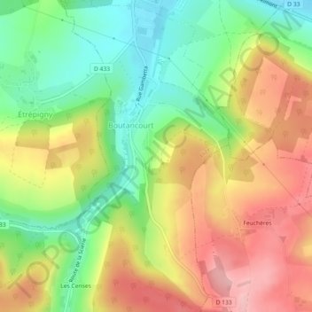
Boutancourt topographic map
Interactive map
Click on the map to display elevation.
About this map
Name: Boutancourt topographic map, elevation, terrain.
Average elevation: 224 m
Minimum elevation: 148 m
Maximum elevation: 305 m
Other topographic maps
Click on a map to view its topography, its elevation and its terrain.
l'étang d'Alger
l'étang d'Alger, D 233, Balaives-et-Butz, Flize, Charleville-Mézières, Ardennes, Grand Est, France métropolitaine, 08160, France
Average elevation: 233 m