
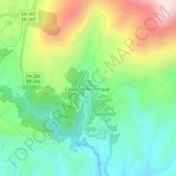
Caldas de Monchique topographic map
Interactive map
Click on the map to display elevation.
About this map
Name: Caldas de Monchique topographic map, elevation, terrain.
Location: Caldas de Monchique, Monchique, Faro, Algarve, Portugal (37.28220 -8.55604 37.29084 -8.55131)
Average elevation: 301 m
Minimum elevation: 109 m
Maximum elevation: 651 m
Other topographic maps
Click on a map to view its topography, its elevation and its terrain.
Caldas de Monchique
Portugal > Algarve > Caldas de Monchique > Caldas de Monchique
Caldas de Monchique, Monchique, Caldas de Monchique, Faro, Algarve, 8550-245, Portugal
Average elevation: 300 m