
Evingsen topographic map
Interactive map
Click on the map to display elevation.
About this map
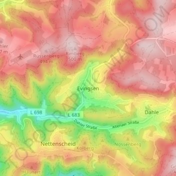
Name: Evingsen topographic map, elevation, terrain.
Average elevation: 399 m
Minimum elevation: 221 m
Maximum elevation: 509 m
Other topographic maps
Click on a map to view its topography, its elevation and its terrain.
Grünewiese
Deutschland > Nordrhein-Westfalen > Märkischer Kreis > Altena
Grünewiese, Altena, Märkischer Kreis, Nordrhein-Westfalen, 58513, Deutschland
Average elevation: 367 m
Wixberg
Deutschland > Nordrhein-Westfalen > Märkischer Kreis > Altena
Wixberg, Altena, Märkischer Kreis, Nordrhein-Westfalen, 58769, Deutschland
Average elevation: 276 m