Geolocate

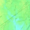
Lockbourne topographic map

Click on the map to display elevation.

About this map
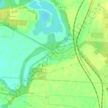
Name: Lockbourne topographic map, elevation, terrain.

Location: Lockbourne, Franklin County, Ohio, United States (39.80271 -82.99600 39.81514 -82.96502)

Average elevation: 216 m

Minimum elevation: 205 m

Maximum elevation: 225 m

Other topographic maps

Click on a map to view its topography, its elevation and its terrain.
Columbus

United States > Ohio > Franklin County > Columbus

The confluence of the Scioto and Olentangy rivers is just north-west of Downtown Columbus. Several smaller tributaries course through the Columbus metropolitan area, including Alum Creek, Big Walnut Creek, and Darby Creek. Columbus is considered to have relatively flat topography thanks to a large glacier that…

Average elevation: 255 m
Blacklick

United States > Ohio > Franklin County

Average elevation: 288 m

Galloway

United States > Ohio > Franklin County

Average elevation: 276 m

Roseland

United States > Ohio > Franklin County > Columbus

Average elevation: 245 m

Flint

United States > Ohio > Franklin County

Average elevation: 279 m

Sandy Corners

United States > Ohio > Franklin County > Dublin

Average elevation: 282 m

Mifflinville

United States > Ohio > Franklin County

Average elevation: 259 m

Briarcliff

United States > Ohio > Franklin County > Reynoldsburg

Average elevation: 270 m

Havens Corners

United States > Ohio > Franklin County

Average elevation: 296 m

Shepard

United States > Ohio > Franklin County > Columbus

Average elevation: 245 m

Wrexham Park

United States > Ohio > Franklin County > Columbus

Average elevation: 234 m

Unique Tree

United States > Ohio > Franklin County

Average elevation: 272 m

Bexley

United States > Ohio > Franklin County > Bexley > Bexley

Average elevation: 243 m

Gear up for your next adventure:

📍Handheld GPS - GPS devices for hiking and navigation
⌚Altimeter Barometer Watches - Outdoor watches with built-in sensors to track altitude changes and weather shifts
👄SPF Lip Balm - Prevent sun and wind-burnt lips on mountain ridges
📦Crushproof Equipment Cases - Safe transport for sensitive surveying and mapping instruments
📣High-Decibel Survival Whistles - Signaling tool for rescue that carries much further than a human voice

As an Amazon Associate, this site earns from qualifying purchases at no extra cost to you.