
Wallingford topographic map
Interactive map
Click on the map to display elevation.
About this map
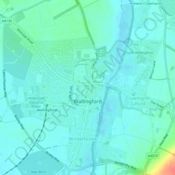
Name: Wallingford topographic map, elevation, terrain.
Average elevation: 51 m
Minimum elevation: 42 m
Maximum elevation: 93 m
Other topographic maps
Click on a map to view its topography, its elevation and its terrain.
Newnham Murren
United Kingdom > England > Oxfordshire > South Oxfordshire > Crowmarsh Gifford
Newnham Murren, Crowmarsh, Crowmarsh Gifford, South Oxfordshire, Oxfordshire, England, OX10 8BW, United Kingdom
Average elevation: 59 m