Geolocate

Corn topographic map

Click on the map to display elevation.

About this map
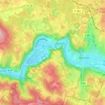
Name: Corn topographic map, elevation, terrain.

Location: Corn, Figeac, Lot, Occitania, Metropolitan France, 46100, France (44.57622 1.85378 44.62917 1.91567)

Average elevation: 286 m

Minimum elevation: 165 m

Maximum elevation: 424 m

Gear up for your next adventure:

📻Handheld UHF Radios - Critical communication for groups in the Australian outback
🩹Blister Prevention Tape - Apply to friction points before they become painful sores
🧯Animal Deterrent Spray - Safety spray for wildlife
🧦Merino Wool Hiking Socks - Moisture-wicking socks to prevent blisters during long topographic surveys
📡Weather Radios - Emergency weather radios

As an Amazon Associate, this site earns from qualifying purchases at no extra cost to you.