Geolocate

Dahej topographic map

Click on the map to display elevation.

About this map

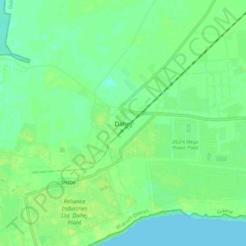
Name: Dahej topographic map, elevation, terrain.

Location: Dahej, Vagra Taluka, Bharuch District, Gujarat, 393125, India (21.67184 72.54981 21.75184 72.62981)

Average elevation: 6 m

Minimum elevation: 0 m

Maximum elevation: 11 m

Gear up for your next adventure:

GPS Watches - GPS watches for outdoor sports
🧥Softshell Jackets - Flexible outdoor jackets
📷Backpack Camera Clips - Quick access to your camera while keeping your hands free for climbing
Altimeter Barometer Watches - Outdoor watches with built-in sensors to track altitude changes and weather shifts
🐍Snake Gaiters - Protection against snake bites

As an Amazon Associate, this site earns from qualifying purchases at no extra cost to you.