
Akrotiri British Sovereign Base Area topographic map
Interactive map
Click on the map to display elevation.
About this map
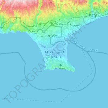
Name: Akrotiri British Sovereign Base Area topographic map, elevation, terrain.
Location: Akrotiri British Sovereign Base Area, Cyprus (34.51277 32.75451 34.70607 33.09695)
Average elevation: 53 m
Minimum elevation: -6 m
Maximum elevation: 554 m