
Cave Hill topographic map
Interactive map
Click on the map to display elevation.
About this map
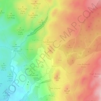
Name: Cave Hill topographic map, elevation, terrain.
Average elevation: 351 m
Minimum elevation: 251 m
Maximum elevation: 447 m
Other topographic maps
Click on a map to view its topography, its elevation and its terrain.
Rylstone
United Kingdom > England > North Yorkshire > Craven > Rylstone
Rylstone, Craven, North Yorkshire, Yorkshire and the Humber, England, BD23 6LH, United Kingdom
Average elevation: 236 m