
Louisburg topographic map
Interactive map
Click on the map to display elevation.
About this map
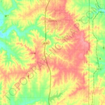
Name: Louisburg topographic map, elevation, terrain.
Location: Louisburg, Miami County, Kansas, United States (38.49482 -94.70882 38.65004 -94.63925)
Average elevation: 316 m
Minimum elevation: 270 m
Maximum elevation: 357 m
Other topographic maps
Click on a map to view its topography, its elevation and its terrain.
Osawatomie
United States > Kansas > Miami County
Osawatomie, Miami County, Kansas, 66064, United States
Average elevation: 273 m