
Ile aux Cerfs topographic map
Interactive map
Click on the map to display elevation.
About this map
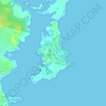
Name: Ile aux Cerfs topographic map, elevation, terrain.
Location: Ile aux Cerfs, Grand River South-East, Flacq, Mauritius (-20.28033 57.79754 -20.26374 57.81006)
Average elevation: 2 m
Minimum elevation: -2 m
Maximum elevation: 20 m