
Umboi topographic map
Interactive map
Click on the map to display elevation.
About this map
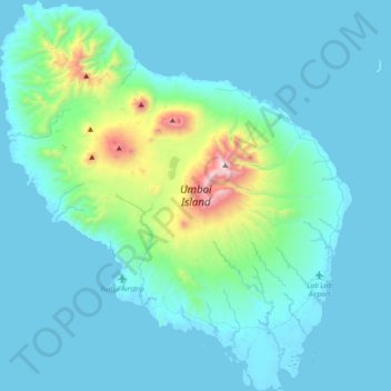
Name: Umboi topographic map, elevation, terrain.
Average elevation: 177 m
Minimum elevation: 0 m
Maximum elevation: 1,602 m
Other topographic maps
Click on a map to view its topography, its elevation and its terrain.
Ritter-Insel
Ritter-Insel, Finschhafen District, Morobe, Momase Region, Papua-Neuguinea
Average elevation: 1 m