
Lyrup topographic map
Interactive map
Click on the map to display elevation.
About this map
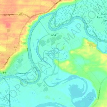
Name: Lyrup topographic map, elevation, terrain.
Average elevation: 26 m
Minimum elevation: 11 m
Maximum elevation: 64 m
Other topographic maps
Click on a map to view its topography, its elevation and its terrain.
Renmark
Australia > South Australia > Renmark Paringa Council
Renmark, Renmark Paringa Council, South Australia, 5341, Australia
Average elevation: 21 m