Geolocate

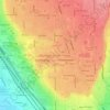
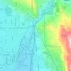
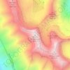
Alpine topographic map

Click on the map to display elevation.

About this map

Name: Alpine topographic map, elevation, terrain.

Location: Alpine, Utah County, Utah, 84004, United States (40.43746 -111.79872 40.49403 -111.74485)

Average elevation: 1,664 m

Minimum elevation: 1,465 m

Maximum elevation: 2,173 m

Other topographic maps

Click on a map to view its topography, its elevation and its terrain.
Mount Timpanogos

United States > Utah > Utah County

Average elevation: 3,139 m

Spanish Fork Peak

United States > Utah > Utah County

Average elevation: 2,720 m

Aspen Grove

United States > Utah > Utah County

Average elevation: 2,358 m

Edgemont

United States > Utah > Utah County > Provo

Average elevation: 1,538 m

Lone Peak

United States > Utah > Utah County

Average elevation: 3,013 m

Bald Mountain Overlook

United States > Utah > Utah County

Average elevation: 2,552 m

Curtis

United States > Utah > Utah County > Orem

Average elevation: 1,433 m

Mount Timpanogos

United States > Utah > Utah County

Average elevation: 3,139 m

Nutty Putty Cave

United States > Utah > Utah County

Average elevation: 1,547 m

Mount Timpanogos

United States > Utah > Utah County

Average elevation: 3,139 m

Mount Nebo

United States > Utah > Utah County

Average elevation: 3,115 m

Lone Peak

United States > Utah > Utah County

Average elevation: 3,013 m

Mount Timpanogos

United States > Utah > Utah County

Average elevation: 3,139 m

Curtis

United States > Utah > Utah County > Orem

Average elevation: 1,433 m

Caryhurst

United States > Utah > Utah County > Provo

Average elevation: 1,563 m

Pleasant View

United States > Utah > Utah County > Provo

Average elevation: 1,446 m

Townsend

United States > Utah > Utah County > Genola

Average elevation: 1,438 m

Birdseye

United States > Utah > Utah County

Average elevation: 1,780 m

Gear up for your next adventure:

🩹Blister Prevention Tape - Apply to friction points before they become painful sores
🥾Hiking Boots - Durable hiking boots for trails and rough terrain
📻Handheld UHF Radios - Critical communication for groups in the Australian outback
👟Lightweight Trail Runners - Agile footwear for fast movement over rugged Australian terrain
🪢550 Survival Paracord - Versatile cordage for gear repair and emergency lashing

As an Amazon Associate, this site earns from qualifying purchases at no extra cost to you.