Geolocate

Fort Apache topographic map

Click on the map to display elevation.

About this map

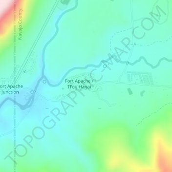
Name: Fort Apache topographic map, elevation, terrain.

Location: Fort Apache, Navajo County, Arizona, 85926, United States (33.78281 -110.00065 33.79759 -109.96939)

Average elevation: 1,557 m

Minimum elevation: 1,494 m

Maximum elevation: 1,795 m

Gear up for your next adventure:

Altimeter Watches - Watches with altitude tracking
GPS Watches - GPS watches for outdoor sports
🩹Blister Prevention Tape - Apply to friction points before they become painful sores
🪫Rechargeable Headlamps - USB rechargeable headlamps
🥾Hiking Gaiters - Leg protection for trails

As an Amazon Associate, this site earns from qualifying purchases at no extra cost to you.