Geolocate

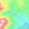
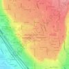
Springville topographic map

Click on the map to display elevation.

About this map
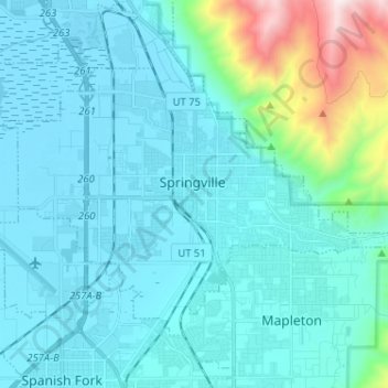
Name: Springville topographic map, elevation, terrain.

Location: Springville, Utah County, Utah, 84663, United States (40.13000 -111.67426 40.19416 -111.54575)

Average elevation: 1,566 m

Minimum elevation: 1,365 m

Maximum elevation: 2,932 m

Other topographic maps

Click on a map to view its topography, its elevation and its terrain.
Spanish Fork Peak

United States > Utah > Utah County

Average elevation: 2,720 m

Edgemont

United States > Utah > Utah County > Provo

Average elevation: 1,538 m

Lone Peak

United States > Utah > Utah County

Average elevation: 3,013 m

Mount Timpanogos

United States > Utah > Utah County

Average elevation: 3,139 m

Bald Mountain Overlook

United States > Utah > Utah County

Average elevation: 2,552 m

Curtis

United States > Utah > Utah County > Orem

Average elevation: 1,433 m

Mount Timpanogos

United States > Utah > Utah County

Average elevation: 3,139 m

Mount Timpanogos

United States > Utah > Utah County

Average elevation: 3,139 m

Mount Nebo

United States > Utah > Utah County

Average elevation: 3,115 m

Nutty Putty Cave

United States > Utah > Utah County

Average elevation: 1,547 m

Mount Timpanogos

United States > Utah > Utah County

Average elevation: 3,139 m

Lone Peak

United States > Utah > Utah County

Average elevation: 3,013 m

Curtis

United States > Utah > Utah County > Orem

Average elevation: 1,433 m

Caryhurst

United States > Utah > Utah County > Provo

Average elevation: 1,563 m

Pleasant View

United States > Utah > Utah County > Provo

Average elevation: 1,446 m

Birdseye

United States > Utah > Utah County

Average elevation: 1,780 m

Townsend

United States > Utah > Utah County > Genola

Average elevation: 1,438 m

Gear up for your next adventure:

🧴SPF 50+ Bulk Sunscreen - Maximum protection for long-term outdoor exposure
🧼Clip-on Hand Sanitizer - Maintain hygiene when water for washing is scarce
🔥Camping Stoves - Portable stoves for outdoor cooking
📸Action Cameras - Record your journey across interesting topographic features in 4K
🎒3L Hydration Reservoirs - Hands-free drinking to stay hydrated on steep contour climbs

As an Amazon Associate, this site earns from qualifying purchases at no extra cost to you.