
Deer Valley topographic map
Interactive map
Click on the map to display elevation.
About this map
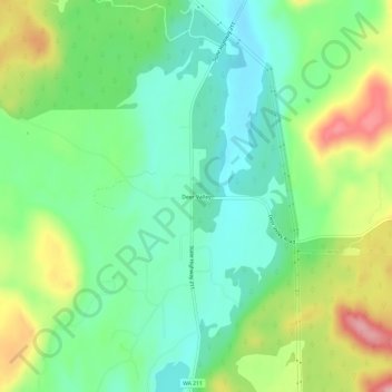
Name: Deer Valley topographic map, elevation, terrain.
Average elevation: 724 m
Minimum elevation: 667 m
Maximum elevation: 832 m
Other topographic maps
Click on a map to view its topography, its elevation and its terrain.
Pend Orielle River
United States > Washington > Pend Oreille County
Pend Orielle River, Pend Oreille County, Washington, 83822, United States
Average elevation: 1,060 m