
Ellington topographic map
Interactive map
Click on the map to display elevation.
About this map
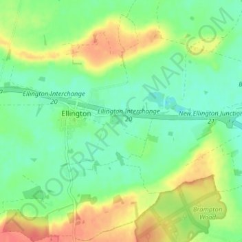
Name: Ellington topographic map, elevation, terrain.
Average elevation: 27 m
Minimum elevation: 6 m
Maximum elevation: 59 m
Other topographic maps
Click on a map to view its topography, its elevation and its terrain.
St. Ives
United Kingdom > England > Cambridgeshire > Huntingdonshire > St. Ives
St. Ives, Huntingdonshire, Cambridgeshire, East of England, England, United Kingdom
Average elevation: 16 m