
Awassa topographic map
Interactive map
Click on the map to display elevation.
About this map
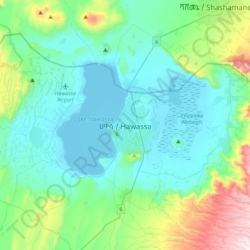
Name: Awassa topographic map, elevation, terrain.
Location: Awassa, Sidama, 1923, Äthiopien (6.88810 38.31861 7.20810 38.63861)
Average elevation: 1,862 m
Minimum elevation: 1,682 m
Maximum elevation: 2,632 m