
Thank you for supporting this site ❤️
Make a donation
Make a donation
Gear up for your next adventure:
As an Amazon Associate, this site earns from qualifying purchases at no extra cost to you.
Ifil topographic map
Click on the map to display elevation.
Thank you for supporting this site ❤️
Make a donation
Make a donation
Gear up for your next adventure:
As an Amazon Associate, this site earns from qualifying purchases at no extra cost to you.
About this map
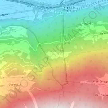
Name: Ifil topographic map, elevation, terrain.
Location: Ifil, Turtmann-Unterems, Leuk, Wallis, 3948, Switzerland (46.28412 7.73088 46.30412 7.75088)
Average elevation: 1,255 m
Minimum elevation: 625 m
Maximum elevation: 2,038 m
Thank you for supporting this site ❤️
Make a donation
Make a donation
Gear up for your next adventure:
As an Amazon Associate, this site earns from qualifying purchases at no extra cost to you.