
Дарьганга topographic map
Interactive map
Click on the map to display elevation.
About this map
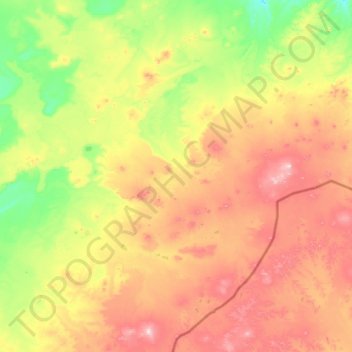
Name: Дарьганга topographic map, elevation, terrain.
Location: Дарьганга, Sühbaatar, Mongolie (45.02253 113.46831 45.87055 114.74475)
Average elevation: 1,301 m
Minimum elevation: 1,058 m
Maximum elevation: 1,738 m
Other topographic maps
Click on a map to view its topography, its elevation and its terrain.