
Hillsboro topographic map
Interactive map
Click on the map to display elevation.
About this map
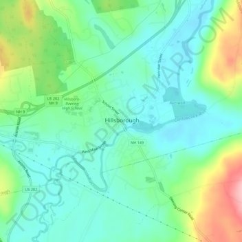
Name: Hillsboro topographic map, elevation, terrain.
Location: Hillsboro, Hillsborough County, New Hampshire, 03244, USA (43.09480 -71.91508 43.13480 -71.87508)
Average elevation: 204 m
Minimum elevation: 162 m
Maximum elevation: 309 m