
Llafranc topographic map
Interactive map
Click on the map to display elevation.
About this map
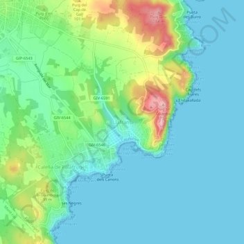
Name: Llafranc topographic map, elevation, terrain.
Average elevation: 38 m
Minimum elevation: -2 m
Maximum elevation: 158 m
Other topographic maps
Click on a map to view its topography, its elevation and its terrain.
Calella de Palafrugell
Espagne > Catalogne > Bas-Ampurdan > Palafrugell
Calella de Palafrugell, Palafrugell, Bas-Ampurdan, Gérone, Catalogne, 17210, Espagne
Average elevation: 40 m