Geolocate

Kumbalam topographic map

Click on the map to display elevation.

About this map

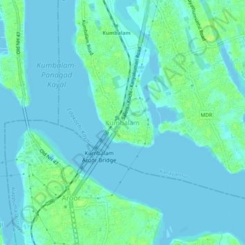
Name: Kumbalam topographic map, elevation, terrain.

Location: Kumbalam, Kanayannur, Ernakulam District, Kerala, 682506, India (9.87064 76.29237 9.91064 76.33237)

Average elevation: 4 m

Minimum elevation: -2 m

Maximum elevation: 13 m

Other topographic maps

Click on a map to view its topography, its elevation and its terrain.

Thrikkakara

India > Kerala > Kanayannur > Thrippunithura

Average elevation: 7 m

Mulavukad

India > Kerala > Kanayannur > Ernakulam

Average elevation: 3 m

Edapally

India > Kerala > Kanayannur > Edapally

Average elevation: 9 m

Kochi

India > Kerala > Kanayannur > Ernakulam

Average elevation: 5 m

Chithrapuzha

India > Kerala > Kanayannur > Ernakulam

Average elevation: 9 m

Moovattupuzha

India > Kerala > Kanayannur > Poothotta

Average elevation: 4 m

Vennala

India > Kerala > Kanayannur > Ernakulam

Average elevation: 8 m

Kochi

India > Kerala > Kanayannur > Ernakulam

Average elevation: 5 m

Mulamthuruthy

India > Kerala > Kanayannur > Mulanthuruthy

Average elevation: 21 m

Gear up for your next adventure:

🖼️Scratch-off Australia Map - Track the regions and peaks you have explored geographically
🦯Adjustable Trekking Poles - Reduce impact on knees when descending steep topographic ridges
🦟Heavy Duty Insect Repellent - Essential protection against flies, mozzies, and march flies
🦶Orthotic Hiking Insoles - Extra arch support for long-distance topographic treks
📟Satellite Messengers - Two-way satellite communication to stay in touch beyond the cellular grid

As an Amazon Associate, this site earns from qualifying purchases at no extra cost to you.