Geolocate

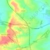
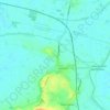
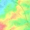
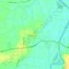
Laneham topographic map

Click on the map to display elevation.

About this map

Name: Laneham topographic map, elevation, terrain.

Location: Laneham, Bassetlaw, Nottinghamshire, England, DN22 0NW, United Kingdom (53.25688 -0.81708 53.29688 -0.77708)

Average elevation: 10 m

Minimum elevation: -4 m

Maximum elevation: 32 m

Other topographic maps

Click on a map to view its topography, its elevation and its terrain.
Tuxford

United Kingdom > England > Nottinghamshire > Bassetlaw

Average elevation: 48 m

Gamston

United Kingdom > England > Nottinghamshire > Bassetlaw

Average elevation: 32 m

Ordsall

United Kingdom > England > Nottinghamshire > Bassetlaw

Average elevation: 25 m

Rhodesia

United Kingdom > England > Nottinghamshire > Bassetlaw > Worksop

Average elevation: 48 m

Hodsock

United Kingdom > England > Nottinghamshire > Bassetlaw

Average elevation: 27 m

Sutton

United Kingdom > England > Nottinghamshire > Bassetlaw

Average elevation: 14 m

Misson

United Kingdom > England > Nottinghamshire > Bassetlaw

Average elevation: 6 m

Lound

United Kingdom > England > Nottinghamshire > Bassetlaw

Average elevation: 12 m

Ranskill

United Kingdom > England > Nottinghamshire > Bassetlaw

Average elevation: 15 m

Ragnall

United Kingdom > England > Nottinghamshire > Bassetlaw > Ragnall

Average elevation: 11 m

Askham

United Kingdom > England > Nottinghamshire > Bassetlaw

Average elevation: 44 m

Mattersey

United Kingdom > England > Nottinghamshire > Bassetlaw

Average elevation: 11 m

West Burton

United Kingdom > England > Nottinghamshire > Bassetlaw

A topographical survey of the deserted village of West Burton was carried out by a team from Nottinghamshire County Council's community archaeology service in 2008–09.

Average elevation: 9 m

Blyth

United Kingdom > England > Nottinghamshire > Bassetlaw

Average elevation: 18 m

Scrooby

United Kingdom > England > Nottinghamshire > Bassetlaw > Scrooby

Average elevation: 13 m

West Burton

United Kingdom > England > Nottinghamshire > Bassetlaw > Bole

A topographical survey of the deserted village of West Burton was carried out by a team from Nottinghamshire County Council's community archaeology service in 2008–09.

Average elevation: 9 m
Gear up for your next adventure:

🧥Insulated Down Jackets - High warmth-to-weight ratio for cold nights in the high country
⛺Ultralight Solo Tents - Compact shelters for multi-day topographic surveying expeditions
🖼️Scratch-off Australia Map - Track the regions and peaks you have explored geographically
📕Australia Maps - Maps covering Australian regions
🍳Ultralight Camping Stoves - Boil water quickly for meals using minimal fuel

As an Amazon Associate, this site earns from qualifying purchases at no extra cost to you.