
Falcon topographic map
Click on the map to display elevation.
About this map
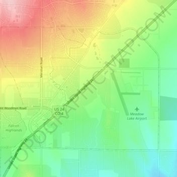
Name: Falcon topographic map, elevation, terrain.
Location: Falcon, El Paso County, Colorado, 80831, United States (38.92546 -104.63531 38.97005 -104.55285)
Average elevation: 2,096 m
Minimum elevation: 2,025 m
Maximum elevation: 2,208 m
Other topographic maps
Click on a map to view its topography, its elevation and its terrain.
Colorado Springs
United States > Colorado > El Paso County
At 6,035 feet (1,839 m) the city stands over 1 mile (1.6 km) above sea level. Colorado Springs is near the base of Pikes Peak, which rises 14,115 feet (4,302.31 m) above sea level on the eastern edge of the Southern Rocky Mountains. The city is the largest city north of Mexico above 6000 feet in elevation.
Average elevation: 2,229 m
Manitou Springs
United States > Colorado > El Paso County > Manitou Springs
Average elevation: 2,109 m