
Abercastle topographic map
Interactive map
Click on the map to display elevation.
About this map
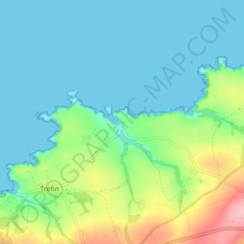
Name: Abercastle topographic map, elevation, terrain.
Average elevation: 34 m
Minimum elevation: 0 m
Maximum elevation: 137 m
Other topographic maps
Click on a map to view its topography, its elevation and its terrain.
Penparc
United Kingdom > Wales > Pembrokeshire > Trevine
Penparc, Llanrhian, Trevine, Pembrokeshire, Wales, SA62 5AG, United Kingdom
Average elevation: 83 m