
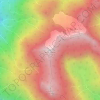
Area C (Long Beach) topographic map
Interactive map
Click on the map to display elevation.
About this map
Name: Area C (Long Beach) topographic map, elevation, terrain.
Average elevation: 1,379 m
Minimum elevation: 619 m
Maximum elevation: 1,852 m
Other topographic maps
Click on a map to view its topography, its elevation and its terrain.
Tofino
Canada > British Columbia > Alberni-Clayoquot Regional District
Tofino, Alberni-Clayoquot Regional District, British Columbia, V0R 2Z0, Canada
Average elevation: 8 m
Port Alberni
Canada > British Columbia > Alberni-Clayoquot Regional District
Port Alberni, Alberni-Clayoquot Regional District, British Columbia, Canada
Average elevation: 83 m
Ucluelet
Canada > British Columbia > Alberni-Clayoquot Regional District
Ucluelet, Alberni-Clayoquot Regional District, British Columbia, V0R 3A0, Canada
Average elevation: 24 m
Escalante River
Canada > British Columbia > Alberni-Clayoquot Regional District > Area C (Long Beach)
Escalante River, Area C (Long Beach), Alberni-Clayoquot Regional District, British Columbia, Canada
Average elevation: 419 m
Pacific Rim National Park Reserve of Canada
Canada > British Columbia > Alberni-Clayoquot Regional District
Pacific Rim National Park Reserve of Canada, Alberni-Clayoquot Regional District, British Columbia, V0R 1A0, Canada
Average elevation: 84 m
Bamfield
Canada > British Columbia > Alberni-Clayoquot Regional District > Area A (Bamfield)
Bamfield, Area A (Bamfield), Alberni-Clayoquot Regional District, British Columbia, V0R 1B0, Canada
Average elevation: 16 m
5040 Peak
Canada > British Columbia > Alberni-Clayoquot Regional District > Area D (Sproat Lake)
5040 Peak, Area D (Sproat Lake), Alberni-Clayoquot Regional District, British Columbia, Canada
Average elevation: 1,092 m
Vargas Island
Canada > British Columbia > Alberni-Clayoquot Regional District > Area C (Long Beach)
Vargas Island, Area C (Long Beach), Alberni-Clayoquot Regional District, British Columbia, Canada
Average elevation: 11 m
Area C (Long Beach)
Canada > British Columbia > Alberni-Clayoquot Regional District
Area C (Long Beach), Alberni-Clayoquot Regional District, British Columbia, Canada, Kennedy Lake
Average elevation: 160 m
Ahousaht
Canada > British Columbia > Alberni-Clayoquot Regional District > Area C (Long Beach)
Ahousaht, Area C (Long Beach), Alberni-Clayoquot Regional District, British Columbia, Canada
Average elevation: 20 m
Pacific Rim National Park Reserve - Broken Group Islands Unit
Canada > British Columbia > Alberni-Clayoquot Regional District > Area C (Long Beach)
Pacific Rim National Park Reserve - Broken Group Islands Unit, Area C (Long Beach), Alberni-Clayoquot Regional District, British Columbia, Canada
Average elevation: 3 m
Comox Glacier
Canada > British Columbia > Alberni-Clayoquot Regional District > Area D (Sproat Lake)
Comox Glacier, Area D (Sproat Lake), Alberni-Clayoquot Regional District, British Columbia, Canada
Average elevation: 1,593 m
Bedwell Lake
Canada > British Columbia > Alberni-Clayoquot Regional District > Area C (Long Beach)
Bedwell Lake, Area C (Long Beach), Alberni-Clayoquot Regional District, British Columbia, Canada
Average elevation: 1,038 m
Clayoquot Sound
Canada > British Columbia > Alberni-Clayoquot Regional District > Area C (Long Beach)
Clayoquot Sound, Area C (Long Beach), Alberni-Clayoquot Regional District, British Columbia, Canada
Average elevation: 101 m
Sproat Lake
Canada > British Columbia > Alberni-Clayoquot Regional District > Area D (Sproat Lake)
Sproat Lake, Area D (Sproat Lake), Alberni-Clayoquot Regional District, British Columbia, Canada
Average elevation: 386 m
Area F (Cherry Creek)
Canada > British Columbia > Alberni-Clayoquot Regional District
Area F (Cherry Creek), Alberni-Clayoquot Regional District, British Columbia, Canada
Average elevation: 457 m
Great Central
Canada > British Columbia > Alberni-Clayoquot Regional District > Area D (Sproat Lake)
Great Central, Area D (Sproat Lake), Alberni-Clayoquot Regional District, British Columbia, Canada
Average elevation: 158 m
Area D (Sproat Lake)
Canada > British Columbia > Alberni-Clayoquot Regional District
Area D (Sproat Lake), Alberni-Clayoquot Regional District, British Columbia, V9Y 8Y5, Canada
Average elevation: 615 m
Area C (Long Beach)
Canada > British Columbia > Alberni-Clayoquot Regional District
Area C (Long Beach), Alberni-Clayoquot Regional District, British Columbia, V0R 1A0, Canada
Average elevation: 316 m