
Rügenwalde topographic map
Interactive map
Click on the map to display elevation.
About this map
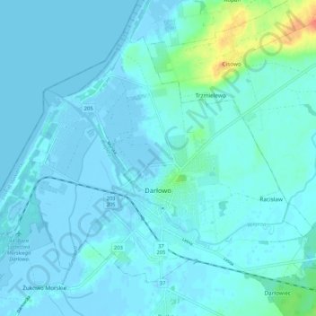
Name: Rügenwalde topographic map, elevation, terrain.
Location: Rügenwalde, powiat sławieński, Woiwodschaft Westpommern, Polen (54.40475 16.35745 54.45272 16.46217)
Average elevation: 5 m
Minimum elevation: -4 m
Maximum elevation: 44 m
Other topographic maps
Click on a map to view its topography, its elevation and its terrain.
Zamek Książąt Pomorskich
Polen > Woiwodschaft Westpommern > Rügenwalde
Zamek Książąt Pomorskich, 4, Zamkowa, Rügenwalde, powiat sławieński, Woiwodschaft Westpommern, 76-153, Polen
Average elevation: 3 m