
City of Velika Gorica topographic map
Interactive map
Click on the map to display elevation.
About this map
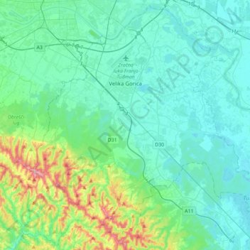
Name: City of Velika Gorica topographic map, elevation, terrain.
Location: City of Velika Gorica, Zagreb County, Croatia (45.55848 15.91995 45.79162 16.26653)
Average elevation: 122 m
Minimum elevation: 95 m
Maximum elevation: 249 m
Other topographic maps
Click on a map to view its topography, its elevation and its terrain.
Gorica Svetojanska
Croatia > Zagreb County > Grad Jastrebarsko > Gorica Svetojanska
Gorica Svetojanska, Grad Jastrebarsko, Zagreb County, 10453, Croatia
Average elevation: 304 m