
Thank you for supporting this site ❤️
Make a donation
Make a donation
Gear up for your next adventure:
As an Amazon Associate, this site earns from qualifying purchases at no extra cost to you.
Futa topographic map
Click on the map to display elevation.
Thank you for supporting this site ❤️
Make a donation
Make a donation
Gear up for your next adventure:
As an Amazon Associate, this site earns from qualifying purchases at no extra cost to you.
About this map
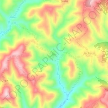
Name: Futa topographic map, elevation, terrain.
Location: Futa, Kozlu, Zonguldak, Black Sea Region, Turkey (41.29737 31.73159 41.33737 31.77159)
Average elevation: 459 m
Minimum elevation: 297 m
Maximum elevation: 614 m
Thank you for supporting this site ❤️
Make a donation
Make a donation
Gear up for your next adventure:
As an Amazon Associate, this site earns from qualifying purchases at no extra cost to you.